A map for the dam
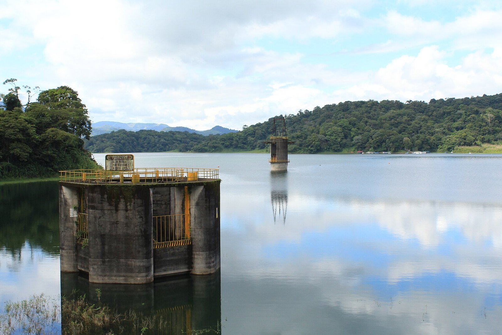
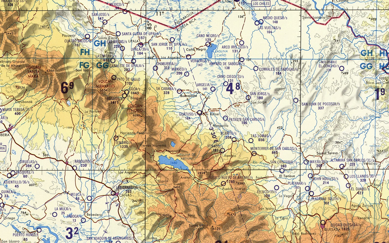
Lago de Cote is a heart-shaped pocket of fresh water about a kilometer across, the flooded crater of an extinct volcano, sitting at some 680 meters in the green hills between the Tenorio and Arenal volcanoes in the north of Costa Rica. It is the country’s largest natural lake, which says more about Costa Rica’s lakes than about this one: it covers under two square kilometers and is eighteen meters deep at its heart. Three kilometers to the south lies Lake Arenal, and beyond it the cone of Arenal itself, which had burst into life in July 1968 after centuries of quiet, burying three villages under ash and rock. In the early 1970s the state electricity company, the Instituto Costarricense de Electricidad, was planning a dam that would turn the little Arenal lagoon into the biggest reservoir in the country, and it needed to know exactly where the water would reach. It asked the Instituto Geográfico Nacional, the national mapping institute, then a department of the public works ministry, for a map of the lake and its surroundings at a scale of 1:10,000 with five-meter contours. The job meant flying the area in a grid and photographing it from the air, the way the institute had learned to do under the eye of the Inter-American Geodetic Survey, the US Army’s mapping program for the region.
Sources: Lago de CoteArenal VolcanoUn ovni sobre el lago Cote: hace 50 años Sergio Loaiza tomó la foto que le cambió la vidaHace 45 años, un OVNI impresionó a Costa Rica y al mundoEl místico y sagrado Lago Cote en Guatuso
The thirteenth mission
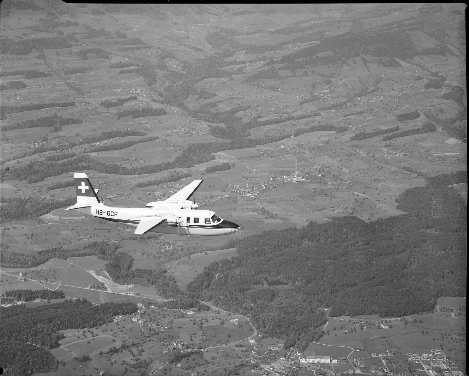
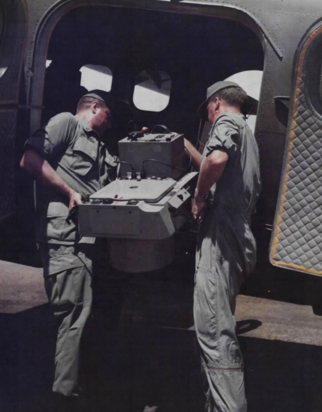
The weather would not cooperate. “Fue hasta la décimo tercera misión que hicimos que pudimos encontrar todo despejado,” Sergio Loaiza told La Nación fifty years later: it was not until the thirteenth attempt that they found everything clear. Loaiza was a cartographer of about twenty-seven from a farm in San Carlos, trained in aerial photography, air navigation and photo-interpretation. On the morning of September 4, 1971, at around eight, he climbed aboard the institute’s twin-engined Aero Commander 680F with the pilot Omar Arias, the topographer and navigator Francisco Reyes and the geographer Juan Bravo. The three technicians took turns at the camera, and that day it was Loaiza’s turn. The camera was a German Zeiss RMK A 15/23, a survey instrument weighing about a hundred pounds, bolted to a leveling mount in the floor of the cabin and pointed through a hatch at the ground, with a 152-millimeter lens and a magazine of 23-by-23-centimeter black-and-white film. Loaiza said it had been a gift of the German government and was so sensitive that a speck of dust between film and lens would stop it working. They flew at 10,000 feet. An intervalometer tripped the shutter automatically, at 1/500 of a second, every twenty seconds, each frame overlapping the last so that the ground could be viewed in stereo. The plane covered San Carlos and Tilarán in long parallel lines. Nobody aboard saw anything unusual. “No había posibilidad de absolutamente nada,” Loaiza said in 2016: there was no possibility of anything at all. “No hay truco, ni siquiera nos dimos cuenta en el momento,” there is no trick, we did not even notice at the time.
Sources: Un ovni sobre el lago Cote: hace 50 años Sergio Loaiza tomó la foto que le cambió la vidaHace 45 años, un OVNI impresionó a Costa Rica y al mundoOvni como el que salió en la foto de la laguna de Cote es el Hyundai del cieloPhoto Analysis of an Aerial Disc Over Costa Rica
What the camera recorded
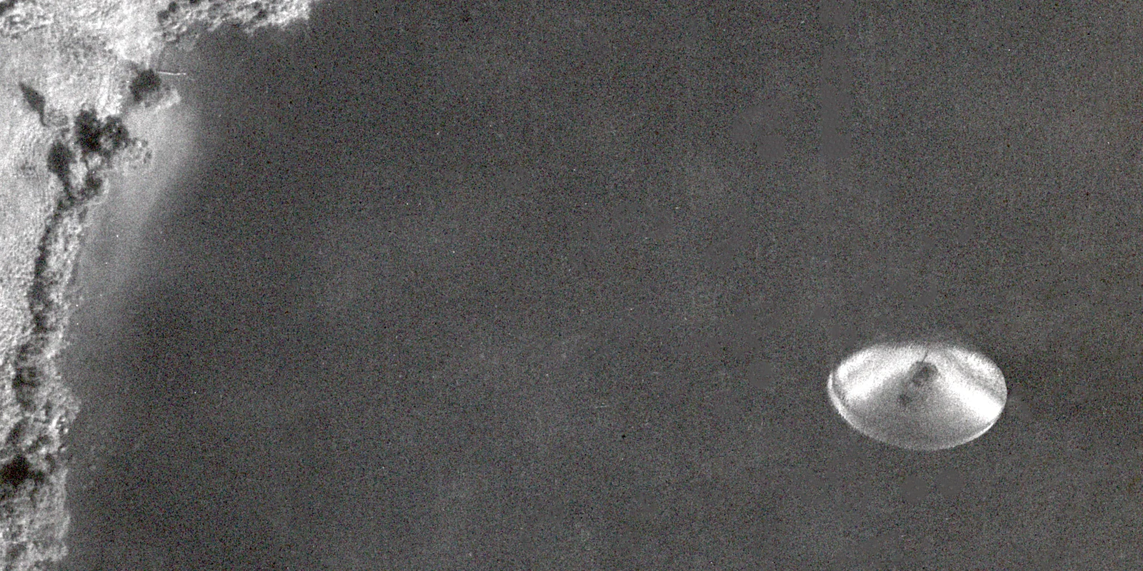
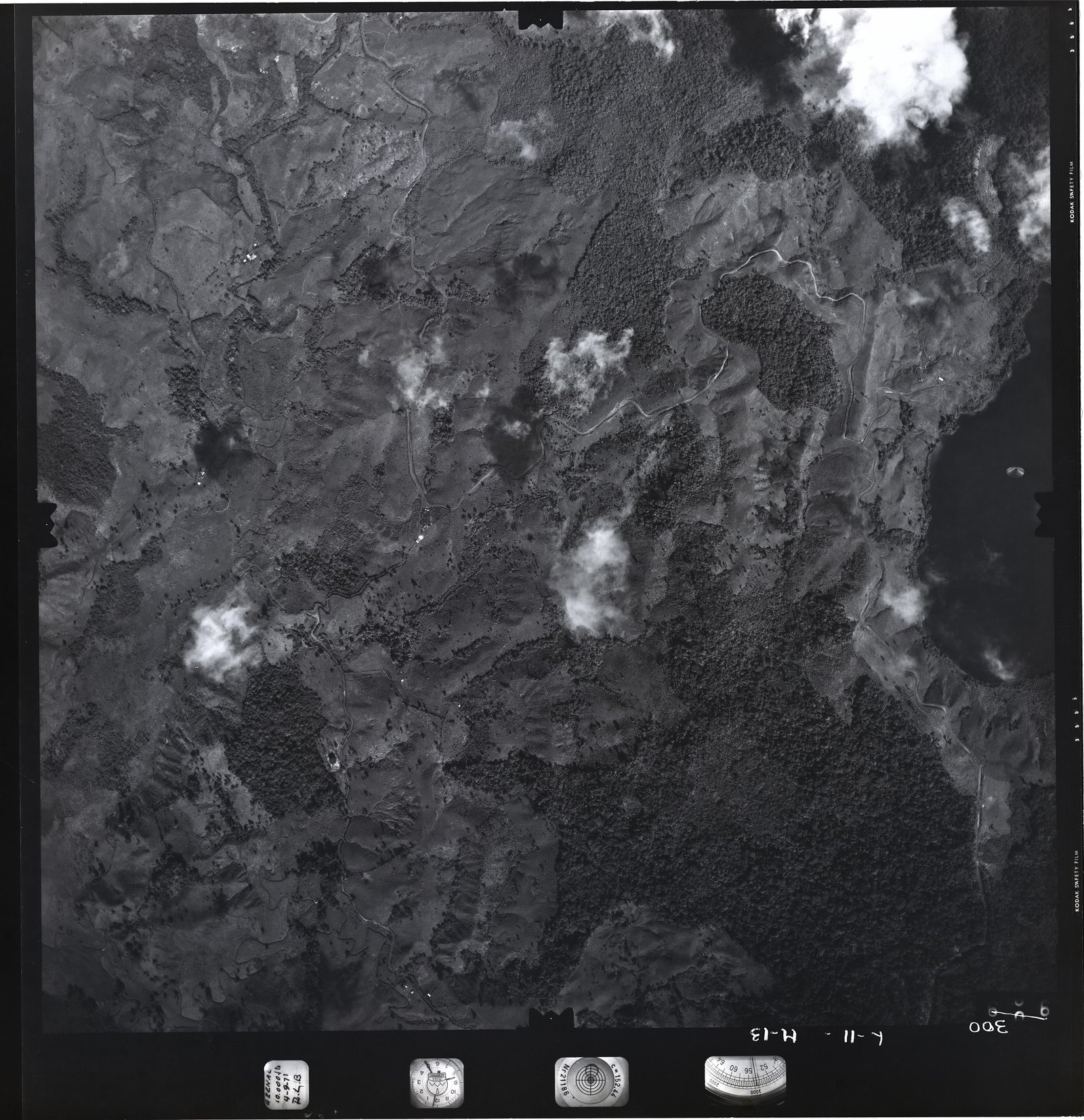
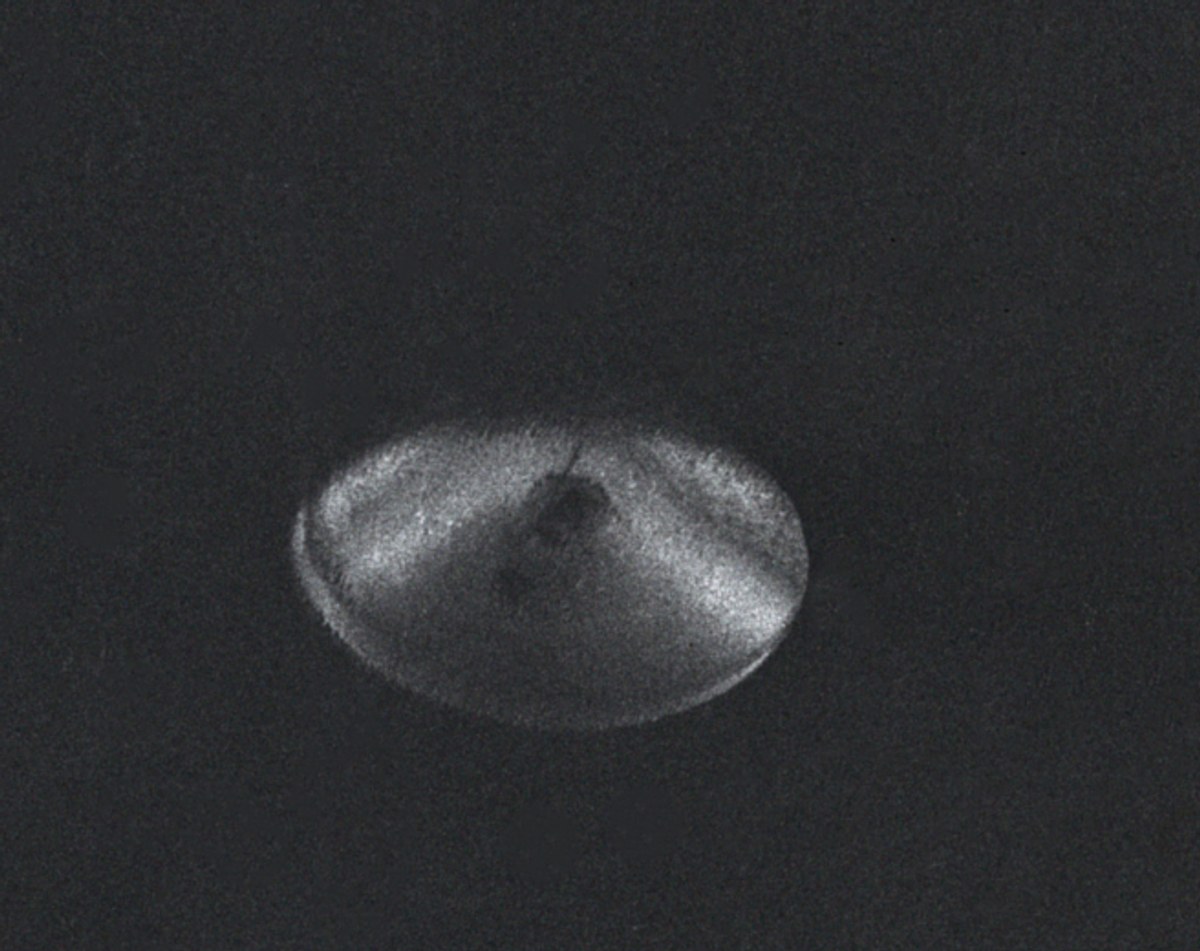
A survey camera writes its own paperwork. Along one edge of every frame the RMK photographed a strip of instruments: a clock, an altimeter, a spirit level, the lens’s calibrated focal length, and a card on which the operator had written the job and the date. On frame 300 the clock reads 8:25, the altimeter 10,000 feet, the bubble sits roughly level, the plate says “Nr 21186” and “c=152.44,” and the card reads “ARENAL, 10.000 ft, 4-9-71” over the initials R.L.B. Someone later wrote “300” and “L-11 H-13” in the margin by hand. The frame itself is a square of hills, pasture, forest and small drifting cumulus clouds, each cloud throwing a crisp shadow a little to one side. Cote lies at the right-hand edge, a black mirror, and on the black, below a wooded point of shoreline where a few farm buildings stand, is the thing. On the negative it measures 4.2 millimeters. Enlarged, it is an oval, brighter than anything on the water, with a razor edge along its northern and eastern rim and a softer, almost smeared edge on the opposite side, a dark wedge of “shadow” opening across its eastern half, and a small dark spot near the center like the tip of a cone. Haines and Vallée would describe shading “typical of a three-dimensional object which is illuminated by sunlight,” and a thin dark line curving inside the eastern edge that suggested the thing had thickness. The frames before and after, 299 and 301, show the same stretch of lake, twenty seconds earlier and later, with nothing on it.
Sources: Photo Analysis of an Aerial Disc Over Costa RicaFile: Sept 1971 – Lake Cote UAP – Full Size RGB Drum Scan.jpgPhoto Analysis of an Aerial Disc Over Costa Rica: New Evidence
“Mirá, ¿qué es esta carajada?”
The map was drawn, delivered and forgotten. By Loaiza’s account, nobody noticed the oval the first time because frame 300 lay on an extra flight line that the cartographers decided not to use. Then, “unos dos o tres años después,” two or three years later, the electricity company came back: some of the data were wrong, and a new study was needed. The field work of photo-interpretation fell to Loaiza. He and his colleagues spread the prints across the big tables they used for choosing frames, and one of them, he recalled, said in the institute’s usual idiom, “Mirá, ¿qué es esta carajada? Parece un platillo volador”: look, what the hell is this thing? It looks like a flying saucer. “Entonces fuimos al laboratorio e hicimos una ampliación y se la llevamos al director del Instituto Geográfico,” so they went to the laboratory, made an enlargement and took it to the institute’s director. The director picked up the telephone and called the engineer in charge of the Inter-American Geodetic Survey, the sister institution on the project, “y nos dijo ahí mismo, en la oficina, que no podíamos hablar con nadie de la foto,” and he told them right there in the office that they could not talk to anyone about the photograph. The order, as Loaiza remembered it, came in English: “This is top secret information.” In those days, he said, such things were respected, especially at an institute that had taken on something of the discipline of the US Army, “que era el que ponía los aviones, los helicópteros, los carros y hasta la plata,” which supplied the planes, the helicopters, the cars and even the money. “Era prohibido hablar del tema porque era un tabú,” it was forbidden to talk about the subject, because it was taboo. Ricardo Vílchez, who would later carry the picture to the world, told the timing differently: in his telling the laboratory staff stumbled on the object by chance eight years after the flight, when someone ordered prints of the area, and at first suspected a drop of developer, until they checked the negative and found no such mark. Both stories may be true. A contact copy of the frame that surfaced in 2021 was dated by Loaiza to about 1975, which suggests copies were being made inside the institute long before anyone outside heard of it.
Sources: Un ovni sobre el lago Cote: hace 50 años Sergio Loaiza tomó la foto que le cambió la vidaHace 45 años, un OVNI impresionó a Costa Rica y al mundoOVNI en la Laguna de Cote – Costa Rica: una mirada histórica a la investigación de una fotografíaPublican nueva imagen en alta resolución del famoso platillo volador sobre el lago de Cote en Costa Rica
A phone call to a photographer
“Todo comenzó en mayo de 1979,” Ricardo Vílchez wrote in 2012: it all began in May 1979, with a telephone call to his photography studio in San José from someone in the institute’s photographic department. They knew he was a photographer, and they knew that he and his twin brother Carlos investigated UFOs; the two had founded a little group with the engineer and contactee Enrique Castillo Rincón, the ICICE, the Instituto Costarricense de Investigaciones Científicas y Exobiológicas. At the ministry the brothers were shown a run of aerial frames and, on one, “un objeto de forma discoidal que no encajaba con la fotografía,” a disc-shaped object that did not belong in the picture. The staff guessed from its size that it might be seventy or eighty meters across. Vílchez saw at once what made the picture unusual: an official document, exposed automatically by high-quality equipment looking down from a known altitude, in the middle of a sequence whose neighbors showed nothing. At the end of May he sent it to Ground Saucer Watch in Arizona, William Spaulding’s group, which was then the ufologists’ clearing house for computer enhancement of photographs. GSW’s first report and its final analysis of October 10, 1979, found the ground features more distorted by the atmosphere than the object, no processing irregularity, a “structured” image rather than a faint reflection, and a diameter of about forty meters. One worry remained: the trailing edge did not match the curve of the leading edge, which could be a cloud wisp or, remotely, a cut-out re-photographed onto the frame, for which they saw no evidence. Verdict: “Imagen de buena fe de un Objeto Aéreo desconocido,” a bona fide image of an unknown aerial object. On Thursday, November 1, 1979, page 4C of La Nación carried the headline “Aseguran que en Costa Rica fue fotografiado un ovni,” with an arrow pointing at the oval. Loaiza was in South America, flying an aerial-photography job in the desert between Ecuador and Peru for an Italian-Venezuelan firm. His wife, Sonia Chaves, cut out the page and mailed it to him, and he wondered how the secret had got out. He still does not know how the Vílchez brothers obtained it. In 1979, at a congress in Bogotá, the brothers handed a copy to J. Allen Hynek, and the Spanish writer J. J. Benítez put it in his three-volume album of a thousand UFO photographs. In 1980 Ricardo Vílchez met Loaiza and heard his story. In 1983 a set of prints carried to the United States by a friend reached an astronomer at the University of Kansas, who passed them to Philip Klass, the arch-skeptic of American ufology. Klass wrote to her that since Vílchez was a professional photographer he “podría haber estado a bordo del vuelo en cuestión,” could have been aboard the flight in question, and thrown the object out of the plane; his colleague Robert Sheaffer thought it “probablemente un reflejo de la lente,” probably a lens reflection. Vílchez obtained a certification from the institute, authenticated by the foreign ministry, that he had never worked there.
Sources: OVNI en la Laguna de Cote – Costa Rica: una mirada histórica a la investigación de una fotografíaUn ovni sobre el lago Cote: hace 50 años Sergio Loaiza tomó la foto que le cambió la vidaCosta Rica UFO Dossier – Pt 1Confrontations: A Scientist’s Search for Alien ContactPhoto Analysis of an Aerial Disc Over Costa Rica
An envelope sealed and signed
In 1985 the brothers organized an international congress in San José on “the great mysteries of man,” and among the speakers were John Keel, J. J. Benítez and Jacques Vallée, the French-born computer scientist and astronomer whose books had made him the most literary of UFO investigators. The Vílchezes handed Vallée an envelope containing a set of prints and the GSW analyses; he sealed and signed it on the spot so that nobody could later say it had been tampered with, and they supplied him with a second-generation negative to take home. Back in California, Vallée first tried, through a friend who was an executive at a California technology company, a “photographic interpretation laboratory located in Washington and connected with the U.S. government.” The analysts would give the frame only a cursory look, worried that serious work “could be construed as a violation of the standards of conduct provisions against misuse of government equipment and personnel,” and that look was unfavorable: the shadows on the ground did not match the shading on the object, the object cast no shadow, and they suspected “a deliberate alteration of the original negative.”
Sources: OVNI en la Laguna de Cote – Costa Rica: una mirada histórica a la investigación de una fotografíaConfrontations: A Scientist’s Search for Alien ContactPhoto Analysis of an Aerial Disc Over Costa RicaCosta Rica UFO Dossier – Pt 1
A pressure mark, or a disc
In December 1987 Vallée started again with Richard F. Haines, a perception psychologist who had spent nearly two decades at NASA’s Ames Research Center and collected pilots’ UFO reports as a sideline. The two enlarged the negative 9.76 times, printed it on papers of different contrast, had a 13-millimeter square around the oval digitized at 16-bit depth, and drew sun-lines from the cloud shadows. The paper they published in the Journal of Scientific Exploration in 1989 found the film grain undisturbed around the oval, “which suggests that it was not the result of a double exposure,” no lines leading to or from it, no heat shimmer, no shadow on the water, and a dark wedge that “cannot be a solar shadow cast by the (assumed) opaque disc from the right-hand side,” so that the light and dark areas were “more likely” surface markings. One side was in “extremely sharp focus with not even the grain structure of the film being apparent,” the other diffuse, a difference they could not explain. If the object was on the water, 10,000 feet from the lens, its 4.2 millimeters on film made it 210 meters, or 683 feet, across: “The object cannot be farther away than this.” Their conclusion: “an unidentified, opaque, aerial object was captured on film at a maximum distance of 10,000 feet,” with “no visible means of lift or propulsion.” The journal printed the paper with a dissent. Marilyn E. Bruner, a senior staff scientist at Lockheed’s Palo Alto research laboratory, wrote that “my impression is that it probably does not represent a physical object.” The northern edge was “abnormally sharp; much sharper, for example, than any physical feature on the coastline,” an edge as abrupt as a step, with none of the halation a bright object should leave on film. The oval, she thought, was “more likely to be an artifact such as a pressure mark,” made by “a foreign particle trapped between two layers of the film on the supply spool,” whose varying thickness would explain the “shadows.” It could be tested, she noted, by examining the original negative under glancing light. Haines and Vallée replied that several rooftops in the frame had sharper edges still, so the lens had not been exceeded, and that a particle pressed into the spool should have dimpled the neighboring frames at a spacing of nine to fourteen inches, where they found nothing. They were, they said, still trying to obtain the original.
Sources: Photo Analysis of an Aerial Disc Over Costa RicaConfrontations: A Scientist’s Search for Alien Contact
Three frames cut from the roll
Vallée wrote to the brothers in September 1989 that the paper had been accepted but that the data could not be finished without the original negatives, which was a pity, because the image seemed to be “una de las evidencias fotográficas más detalladas,” one of the most detailed pieces of photographic evidence, in support of UFOs. The brothers went back to the institute. The negatives were on rolls and would have to be cut, and the photographic department said the only way that would happen was if an American university asked. Vallée arranged for Peter Sturrock, the Stanford astrophysicist who had founded the Society for Scientific Exploration, to write the letter. With it in hand the Vílchezes returned to the department’s director and were lent, on condition of return, the three connected frames 299, 300 and 301 of the original roll. They reached Haines on February 11, 1990, and he wrote to Vílchez that month to say so. Under magnification and glancing light the film plane of all three frames was “flat with absolutely no protrusions or depressions anywhere”: the referee’s pressure mark, the authors wrote, was “shown to be unsupported.” “The image was smooth as glass,” Haines said later, “so it set to rest that argument.” Frames 299 and 301 bore small developer stains on the emulsion side; frame 300 had none. Long scratches ran across the roll, three of them very thin and parallel through the disc itself, a sign that the negative “has received rough usage over the years.” And the original showed something new: along the diffuse western edge, “dozens of thin, parallel fingers of light” fading from the body of the object into the lake, all lying along one oblique line that also governed the two dark patches near the center and the tilt of the rims. “We have no clear understanding of the origin or meaning of this oblique orientation effect.” Since the object appeared on neither neighboring frame, it had entered and left the camera’s field in twenty seconds, which at ground level meant somewhere between 1,425 and nearly 2,000 miles per hour, depending on the path, unless it had “otherwise become invisible.” There was no disturbance of the water on 299 or 301. The four-page follow-up ended: “While it may not be inexplicable, it is at least unidentified.” In April 1996 Haines finally came to Costa Rica with the Chilean-American writer Antonio Huneeus, and on the 13th the Vílchez brothers and the investigator Edgar Picado took him out in a boat on Cote to the point beneath which, by the vertical, the thing would have hung.
Sources: OVNI en la Laguna de Cote – Costa Rica: una mirada histórica a la investigación de una fotografíaPhoto Analysis of an Aerial Disc Over Costa Rica: New EvidenceCosta Rica UFO Dossier – Pt 1
The lake would not stay quiet
On October 25, 1986, a clear morning around nine, a forty-year-old farm manager, Joaquín Umaña Alfaro, and a twenty-three-year-old farmhand, Ronald Alberto López Arrieta, saw a row of three or four dark, post-like cylinders standing about a meter out of the glassy water some 550 meters away, apparently joined to something submerged. They drove their tractor closer and watched the posts tilt together, as if on one hidden structure, and sink back “with significant turmoil and waves.” If they had seen it at sea, they told the Vílchez brothers, who interviewed them at the site two weeks later, they would have taken it for a submarine. Haines and Vallée folded the sighting into their paper, together with a geological chart on which a fault line labelled Fila Vieja Dormida runs almost under the spot where the disc was photographed; what that might mean, they admitted, was unknown. A decade later Huneeus collected fresh stories from the Eco-Lodge above the lake: a spotlight-bright object over a nearby mountain in March 1996 that illuminated the slope beneath it for ten minutes, a guard’s tale of something that drifted over to Lake Arenal and went in, and a boatman who had seen “a very high, isolated and unusual wave in the middle of the lake.” Older threads run under all this. In Maleku tradition, as the regional press tells it, Cóter means love and peace, and the lake was a place of healing where people from far to the south came to prepare to become shamans. At Nuevo Arenal, the town rebuilt on the reservoir’s north shore, an Italian from Turin and his wife run a restaurant called Los Platillos Voladores, the flying saucers; on the day he arrived in 1989, she says, a stranger asked him whether he knew that in the seventies a saucer had come down, lit up the lake and gone into it. A road sign now points to “Cote Lake / Alien Zone.” Loaiza himself went back often, and said that on three later visits, with a group of professionals from San Ramón, with a party of ufologists and on a private visit in January 2018, his photographs again showed a similar object. “Hay muchas clases de ovnis, tantos como carros hay en la tierra,” he told La Teja, there are as many kinds of UFOs as there are cars on earth, “pero ese modelo de la laguna de Cote seguro salió muy bueno porque es muy común,” but the Cote model must have come out well, because it is very common. The paper called it the Hyundai of the sky.
Sources: Photo Analysis of an Aerial Disc Over Costa RicaOVNI en la Laguna de Cote – Costa Rica: una mirada histórica a la investigación de una fotografíaCosta Rica UFO Dossier – Pt 1El místico y sagrado Lago Cote en GuatusoDueño de “restaurante OVNI” en Costa Rica tiene una impresionante historia con extraterrestresCosta Rica’s Mysterious Lago Cote and Its UFO Sighting HistoryOvni como el que salió en la foto de la laguna de Cote es el Hyundai del cielo
The finest image ever made public
By the 1990s the picture had a reputation to live up to. The French COMETA group put it on the cover of its 1999 report on UFOs and defense, and Vílchez counted the 1997 Sturrock panel report, to which Haines and Vallée contributed, among the scientific reports that include it. In 2021 The New Yorker, profiling the journalist Leslie Kean, found on the wall behind her desk “a framed black-and-white image that looks like a sonogram of a Frisbee,” given to her “along with chain-of-custody documentation, by contacts in the Costa Rican government; in her estimation, it is the finest image of a U.F.O. ever made public.” Ten days later Mick West opened a thread on Metabunk to examine it. In San José, meanwhile, an attorney named Esteban Carranza had inherited an eight-by-ten contact copy of frame 300 from an uncle who had obtained it from the institute around the turn of the 1980s. In 2021 he sent it to a laboratory in Liberal, Kansas, where Michael Strickland mounted it on a Heidelberg Tango drum scanner and produced a 1.7-gigabyte file. Carranza showed the sheet to Loaiza, who was thrilled and judged it had been made around 1975, before the famous negative collected its scratches. On May 6, 2022, UAP Media UK released the scan to everyone. “Disclosure is a team effort,” Carranza tweeted, “and everyone should have this image.” The sharper picture settled nothing. The three scratches Haines had described through the disc were not there, either because the copy predates them or because the laboratory’s dust-spotting removed them; Metabunk’s contributors found that four lines around the object had in any case been cleaned off, and West noticed “an odd blotchiness, and a dark streak above the object” and thought the new image pointed, if anything, toward an in-camera or later fake.
Sources: OVNI en la Laguna de Cote – Costa Rica: una mirada histórica a la investigación de una fotografíaHow the Pentagon Started Taking U.F.O.s Seriously1971 Lake Cote / Lago de Cote UFO Aerial PhotoPublican nueva imagen en alta resolución del famoso platillo volador sobre el lago de Cote en Costa RicaCosta Rica 1971: the best UFO photograph ever taken?
Why me?
A film crew from Detroit, Adam Pillon and Megan Woomer, had first seen the print on a friend’s wall near the volcano. Their production had the film cleaned and rescanned at 10,999 dots per inch, and the unretouched file was released in March 2026. On September 4 of that year, the photograph’s fifty-fifth anniversary, their documentary The Cote Photo appeared on Apple TV, following Carranza from the national archive to the hills around the lake and giving Loaiza, at eighty-three by the film’s account, his longest hearing yet. Pillon and Woomer described the film as being about “the humility of saying we don’t know.” The painter Keith Mayerson had already made it a history painting, nine feet wide, with the lake colored from Google Earth and one invention, a shadow. The two brothers who carried the picture out of the institute did not live to see the film. Ricardo and Carlos Vílchez died of COVID-19 three days apart in November 2021, both aged seventy-one. Loaiza, in his armchair opposite the framed print his daughter gave him, has his own answer. He has been seeing things since he was five, he says, lying in a pasture learning the stars from his father; at fifteen a huge, beautiful craft paralyzed him; near the Cerro de la Muerte one night a glowing sphere brought three tall, fair, blue-eyed beings to within a few meters of him, and the man raised a hand. “¿Por qué yo, por qué a mí?” he asks. Why me? And of the governments that still call these things unidentified: “Ellos los tienen muy bien identificados.” They have them very well identified.
Sources: The Lake Cote Photo: The Story Behind the ‘Best Official UFO Image’ Ever Taken — and a New DocumentaryDocumental que se estrena en Apple TV revive uno de los grandes misterios de Costa Rica: la foto del Lago CoteThe Cote Photo1971 Lake Cote / Lago de Cote UFO Aerial Photo“Best Photograph of a UFO Ever Taken”: Costa Rica 1971 by Sergio LoaizaFalleció el ufólogo costarricense Ricardo VílchezUn ovni sobre el lago Cote: hace 50 años Sergio Loaiza tomó la foto que le cambió la vida
What survives
The case rests on a single frame of film and on paper. The original roll, or what was cut from it, is held by the Archivo Nacional de Costa Rica under reference NP-002544, catalogued as five negatives and three positives of “un objeto volador no identificado, fotografiado accidentalmente durante las giras hechas por el Instituto Geográfico Nacional”; Carranza has posted a certified copy of frame 300 that the archive issued in 2014. Haines and Vallée worked first from the second-generation negative Vílchez gave Vallée in 1985 and then, in 1990, from the original frames 299 to 301 on loan. Carranza’s eight-by-ten contact copy, drum-scanned in 2021, is the source of the high-resolution versions now circulating, including the files on Wikimedia Commons used here; it is a contact copy, not the camera negative, and the 2021 scan was retouched, apparently by the laboratory’s default dust-spotting. The documentary record consists of the two Journal of Scientific Exploration papers with Bruner’s dissent, Vallée’s chapter in Confrontations, Ricardo Vílchez’s 2012 account with its quotations from the 1979 GSW findings and the 1983 Klass and Sheaffer letters, Huneeus’s 1996 dossier, and Loaiza’s interviews from 2016 onward. GSW’s own reports and the 1979 La Nación page have not been found online. Haines’s files, including one catalogued “UFO photo: Lago de Cote, Costa Rica, 1986,” are at Rice University. Only Loaiza, of the four men aboard, has ever spoken publicly.
Sources: Fotografías de un objeto volador no identificado, fotografiado accidentalmente durante las giras hechas por el Instituto Geográfico Nacional, en la laguna de Cote1971 Lake Cote / Lago de Cote UFO Aerial PhotoPhoto Analysis of an Aerial Disc Over Costa RicaPhoto Analysis of an Aerial Disc Over Costa Rica: New EvidenceFile: Sept 1971 – Lake Cote UAP – Full Size RGB Drum Scan.jpgOVNI en la Laguna de Cote – Costa Rica: una mirada histórica a la investigación de una fotografíaUFO photo: Lago de Cote, Costa Rica, 1986
The contradictions
The clock on the data strip says 8:25; Loaiza’s 2021 interview says 8:15. The interval between frames is twenty seconds in the 1989 paper, “17 o 20” in Vílchez, seventeen in Vallée’s Confrontations, thirteen in Loaiza’s recollection. The discovery is two or three years after the flight in Loaiza’s telling and eight years after in Vílchez’s; the 1989 paper has the two men meeting in 1980, and Confrontations has Vílchez sending the picture to GSW after that meeting, though his own account dates the dispatch to May 1979. The paper first calls Ricardo’s brother Eduardo, then, correctly, Carlos. It places the lake in Alajuela; Huneeus and the archive catalogue say Guanacaste, whose border runs 800 meters to the south. Estimates of the object’s size run from Spaulding’s forty meters and the institute laboratory’s seventy to eighty, through 84 meters from the straightforward 1:20,000 scale of a 152-millimeter lens at 10,000 feet, to Haines and Vallée’s 210 meters, which rests on their reading that the frame spanned 11.5 kilometers of ground. West georeferenced the frame on satellite imagery and made the oval about 210 feet by 130, suggesting a units slip that “has propagated for decades.” All of these assume the object was at the surface; the closer it was to the lens, the smaller. The paper gives the sun an altitude of 16.7 degrees, but its abstract times the exposure in Eastern Daylight Time; recomputed for 8:25 Costa Rican time, by this archive and by a Metabunk contributor, the sun stands about 42 degrees high, still almost due east, which leaves the shadow-direction argument intact but makes the low-sun explanations built on sixteen degrees shakier. Nobody has explained who authorized the loan of the originals abroad, or when or how the institute’s copies reached the Vílchez brothers.
Sources: Photo Analysis of an Aerial Disc Over Costa RicaConfrontations: A Scientist’s Search for Alien ContactUn ovni sobre el lago Cote: hace 50 años Sergio Loaiza tomó la foto que le cambió la vidaOVNI en la Laguna de Cote – Costa Rica: una mirada histórica a la investigación de una fotografíaCosta Rica UFO Dossier – Pt 11971 Lake Cote / Lago de Cote UFO Aerial PhotoThe Lake Cote Photo: The Story Behind the ‘Best Official UFO Image’ Ever Taken — and a New Documentary
Explanations and objections
The oldest explanation is Bruner’s: a particle pressed between layers of film on the spool, leaving an oval dent whose thickness variations mimic shading. Haines and Vallée answered it with the flat film plane of the original and the absence of matching dimples on the neighboring frames; Metabunk contributors have replied that the mark would have been made in the soft, unexposed emulsion, and that it is not certain the frames Haines examined were the originals. The Rocky Mountain Paranormal Research Society proposed in 2013 that the image was formed by “reflections of ambient light inside the optics of the camera system,” a combination of lens, angle of bank, sun and water that would occur once and cast no shadow; West called this “the most likely explanation (but by no means certain),” and his central objection remains the light: the sun was in the east, the cloud shadows fall to the west, and no rendering of a solid disc makes its bright and dark areas consistent with that. A Spanish skeptic refined the optical idea into a small “bullseye” chip in a glass element catching the sun during a turn, “no es convexo sobre el agua, sino cóncavo en el cristal,” not convex on the water but concave in the glass. Ray Stanford announced in 2013 that the oval was an electric lantern’s reflector superimposed in a darkroom, which sits badly with the undisturbed grain Haines found and the two frames of original film either side. Sheaffer’s lens reflection and a boat’s wake have been proposed and mostly abandoned. On the other side stand the facts that made the frame worth studying: a professional camera, a known altitude, an official archive, no visible manipulation, a uniform background and an object that, to the eye, has the shaded look of a solid thing. What no analysis has produced is a second frame, a shadow, a witness or a convincing account of how a craft tens or hundreds of meters wide could visit a lake in daylight, in twenty seconds, unseen by the people flying over it. Vallée later said a friend’s firm in France, which digitizes satellite imagery, had worked over the three uncut negatives and “could not find an explanation for the object.” Haines and Vallée’s own final word was the most careful: not inexplicable, but unidentified.
Sources: Photo Analysis of an Aerial Disc Over Costa RicaPhoto Analysis of an Aerial Disc Over Costa Rica: New EvidenceAnalysis of 1971 Costa Rica U.F.O. Image1971 Lake Cote / Lago de Cote UFO Aerial PhotoEl OVNI del lago Cote (1971)Famous 1971 Lago de Cote, Costa Rican UFO hoaxed?OVNI en la Laguna de Cote – Costa Rica: una mirada histórica a la investigación de una fotografíaThe Lago de Cote photograph, 1971
Classification and evidence note
This archive files Lago de Cote as an aviation encounter: the record was made from an aircraft, by its crew’s equipment, in the course of a government flight, even though no one aboard saw anything and the encounter, if there was one, was between a camera and whatever lay beneath it. No close-encounter kind is assigned. The evidence is a single, well-documented photographic frame of official origin, supported by its neighbors in the sequence and by instrument data on the film itself, examined on the original negatives by two qualified analysts whose findings were published with a qualified dissent. It is unsupported by any eyewitness, any second image, any radar or any physical trace, and the object’s size and lighting remain unresolved. The archive treats the later sightings at the lake, the Maleku traditions and the photographer’s personal experiences as part of the case’s lore, not as evidence for what is on frame 300.
Sources: Photo Analysis of an Aerial Disc Over Costa RicaPhoto Analysis of an Aerial Disc Over Costa Rica: New Evidence1971 Lake Cote / Lago de Cote UFO Aerial Photo
- JUL 1968
Arenal volcano erupts after centuries of dormancy and buries three villages; the state electricity company will later plan a reservoir at its foot.
- 4 SEP 1971 · 8:25 AM
The Instituto Geográfico Nacional’s Aero Commander photographs the Arenal area from 10,000 feet; frame 300 records an oval over Lago de Cote that nobody aboard sees.
- C. 1973–1974
By Loaiza’s account, a colleague spots the object on a sorting table during a re-study for the electricity company; a telephone call to the American advisers ends in an order of silence.
- C. 1975
Approximate date Loaiza later assigns to a contact copy of the frame made inside the institute.
- MAY 1979
Someone in the institute’s photographic department telephones the photographer and ufologist Ricardo Vílchez; he and his brother Carlos see the frame.
- 10 OCT 1979
Ground Saucer Watch in Arizona delivers its final analysis: a “bona fide image of an unknown aerial object” about forty meters across.
- 1 NOV 1979
La Nación publishes the photograph on page 4C; Loaiza, working in South America, receives the page from his wife.
- 1979
The Vílchez brothers hand a copy to J. Allen Hynek at a congress in Bogotá.
- 1980
Ricardo Vílchez meets Loaiza and hears his account of the flight.
- 7 JUN 1983
Philip Klass suggests in a letter that Vílchez could have been aboard and thrown the object out of the plane; Vílchez obtains a certification that he never worked at the institute.
- 1985
At a congress in San José, Vílchez gives Jacques Vallée a sealed envelope with prints and the GSW analyses, and a copy negative.
- 25 OCT 1986
Two farm workers watch post-like cylinders rise from and sink back into the lake.
- DEC 1987
Richard Haines begins the analysis in California after a Washington laboratory suspects “a deliberate alteration.”
- 1989
Haines and Vallée publish in the Journal of Scientific Exploration: unidentified, up to 210 meters; Marilyn Bruner’s dissent proposes a pressure mark.
- 11 FEB 1990
The original frames 299–301, lent by the institute on a request from Stanford’s Peter Sturrock, reach Haines; the follow-up paper finds the film flat and the disc still unidentified.
- 13 APR 1996
Haines, Antonio Huneeus, the Vílchez brothers and Edgar Picado boat out to the point on the lake beneath the disc.
- 1999
The French COMETA report puts the photograph on its cover.
- 30 APR 2021
The New Yorker describes the print on Leslie Kean’s wall as, in her estimation, the finest UFO image ever made public.
- 10 MAY 2021
Mick West opens the Metabunk thread that will argue over the frame for the next five years.
- 2021
Esteban Carranza has his inherited contact copy drum-scanned in Kansas; by May 2022 he has shown it to Loaiza.
- 3–6 NOV 2021
Ricardo and Carlos Vílchez die of COVID-19 three days apart.
- 13 NOV 2021
La Nación’s fiftieth-anniversary profile: Loaiza tells of the sorting table, the secrecy order and his own encounters.
- 6 MAY 2022
UAP Media UK releases the 1.7-gigabyte scan; Metabunk finds it retouched.
- MAR 2026
The documentary’s production releases an unretouched 10,999-dpi rescan.
- 4 SEP 2026
The Cote Photo is released on the fifty-fifth anniversary of the flight.
Sources & interviews
Photo Analysis of an Aerial Disc Over Costa RicaRichard F. Haines and Jacques F. Vallée · Journal of Scientific Exploration, vol. 3, no. 2 (1989), pp. 113–131, with the dissenting review by Marilyn E. Bruner and the authors’ reply · PDF mirrored by NICAPPhoto Analysis of an Aerial Disc Over Costa Rica: New EvidenceRichard F. Haines and Jacques F. Vallée · Journal of Scientific Exploration, vol. 4, no. 1 (1990), pp. 71–74 · Wayback Machine copy of the Society for Scientific Exploration PDFConfrontations: A Scientist’s Search for Alien ContactJacques Vallée · Ballantine Books, 1990 · chapter “A Parade of Parameters,” pp. 58–60 · Internet ArchiveOVNI en la Laguna de Cote – Costa Rica: una mirada histórica a la investigación de una fotografíaRicardo Vílchez Navamuel · the investigator’s own account, with the 1979 Ground Saucer Watch findings, the 1983 Klass and Sheaffer letters and the 1989–1990 negative loan · blog post, August 2012Un ovni sobre el lago Cote: hace 50 años Sergio Loaiza tomó la foto que le cambió la vidaKimberly Herrera Salazar · La Nación (San José), Revista Dominical · November 13, 2021 · interview with the photographer at his home in PalmaresHace 45 años, un OVNI impresionó a Costa Rica y al mundoJohel Solano · CRHoy.com · August 28, 2016 · with audio clips of Sergio Loaiza and the ufologist Oscar SierraOvni como el que salió en la foto de la laguna de Cote es el Hyundai del cieloFranklin Arroyo · La Teja (San José) · October 4, 2018 · Loaiza on the camera, his later photographs at the lake and his family’s 1966 sightingCosta Rica UFO Dossier – Pt 1Antonio Huneeus · written for Borderland (Tokyo), August 1996, after the April 1996 visit to the lake with Richard Haines and the Vílchez brothers · republished by Open Minds, February 9, 2011Fotografías de un objeto volador no identificado, fotografiado accidentalmente durante las giras hechas por el Instituto Geográfico Nacional, en la laguna de CoteArchivo Nacional de Costa Rica · photograph collection, reference NP-002544 (1–3), “5 negativos, 3 positivos” · online catalogue (the record page may refuse automated requests)File: Sept 1971 – Lake Cote UAP – Full Size RGB Drum Scan.jpgWikimedia Commons · the 2021 drum scan of Esteban Carranza’s contact copy of frame 300, 17,426 × 17,483 pixels, uploaded January 2025 under the PD-Costa Rica tagCosta Rica 1971: the best UFO photograph ever taken?Vinnie Adams · UAP Media UK · May 6, 2022 · release of the high-resolution scan, with Esteban Carranza’s account of the contact negative · Wayback Machine copy (the original domain has since lapsed)Publican nueva imagen en alta resolución del famoso platillo volador sobre el lago de Cote en Costa RicaMystery Planet · May 6, 2022 · Spanish edition of the UAP Media UK release, with Carranza’s tweet and the reactions of Luis Elizondo and Jeremy CorbellHow the Pentagon Started Taking U.F.O.s SeriouslyGideon Lewis-Kraus · The New Yorker · online April 30, 2021; May 10, 2021 issue · the print on Leslie Kean’s wall1971 Lake Cote / Lago de Cote UFO Aerial PhotoMetabunk forum thread opened by Mick West, May 10, 2021, running to 2026 · the units argument, the lighting argument, the retouching of the 2022 scan and the 2026 rescanAnalysis of 1971 Costa Rica U.F.O. ImageRocky Mountain Paranormal Research Society · 2013 · the camera-optics reflection hypothesisEl OVNI del lago Cote (1971)La mentira está ahí fuera · May 30, 2014 · a skeptical reading proposing a chipped glass element lit by the low sunFamous 1971 Lago de Cote, Costa Rican UFO hoaxed?Ray Stanford and others · The Paracast forums · June 2013 · the darkroom-superimposition claim and the replies to itThe Lago de Cote photograph, 1971Patrick Gross · UFOs at close sight · 2001 · summary of the Haines–Vallée papers with a later Vallée interview on a French digital analysisThe Lake Cote Photo: The Story Behind the ‘Best Official UFO Image’ Ever Taken — and a New DocumentaryThe UAP Observer · April 25, 2026 · interview with the director Adam Pillon; the 1:20,000 scale arithmeticDocumental que se estrena en Apple TV revive uno de los grandes misterios de Costa Rica: la foto del Lago CoteFátima Jiménez · La Nación (San José) · September 4, 2026 · the release of The Cote Photo on the photograph’s 55th anniversaryThe Cote PhotoAdam Pillon and Megan Woomer · Great Films LLC, Detroit · 76-minute documentary released September 4, 2026 · official site with the researchers, the experiencers and the scan downloadFalleció el ufólogo costarricense Ricardo VílchezLa Teja (San José) · November 4, 2021Dueño de “restaurante OVNI” en Costa Rica tiene una impresionante historia con extraterrestresSianny Barrantes · La Teja (San José) · November 8, 2023 · the Los Platillos Voladores restaurant at Nuevo Arenal and the local legend of a saucer that entered the lakeEl místico y sagrado Lago Cote en GuatusoMarcela Delgado · San Carlos Digital · July 22, 2024 · the lake in Maleku traditionCosta Rica’s Mysterious Lago Cote and Its UFO Sighting HistoryThe Tico Times · November 12, 2024 · a visit to the lake and its “Alien Zone” road signLago de CoteWikipedia (Spanish) · the lake’s geography: a heart-shaped maar lake of 1.98 square kilometers in Guatuso cantonArenal VolcanoWikipedia (English) · the 1968 eruption and the Arenal reservoir“Best Photograph of a UFO Ever Taken”: Costa Rica 1971 by Sergio LoaizaKeith Mayerson · oil on linen, 60 × 112 inches, 2024, from the series “My American Dream: City of Angels” · the painter’s notesUFO photo: Lago de Cote, Costa Rica, 1986Richard F. Haines Ufology papers, MS 0706, box 11, folder 6 · Woodson Research Center, Rice University · finding aidSpotted an error, or know a better source? Write to hello@uap.fun.
Connected files
The Saturn over TrindadeThe other great Latin American photograph: taken by a man who saw it, developed on a navy ship, and never examined on the original negatives, the mirror image of Cote.The Heat Signature over AguadillaAnother official camera looking down from a government aircraft at an object over water, four decades later and in infrared.The Lights beside the Newspaper PlaneFilm shot from an aircraft that was argued over frame by frame, with witnesses, radar and a camera crew that Cote never had.Jacques ValléeThe investigator who carried the sealed envelope out of San José and co-wrote both analyses.Leslie KeanKeeps the print behind her desk and calls it the finest UFO image made public; appears in the 2026 documentary.Discuss this case
Compare notes with other readers: witness details, sources, and the parts that still do not add up.
Open the discussion